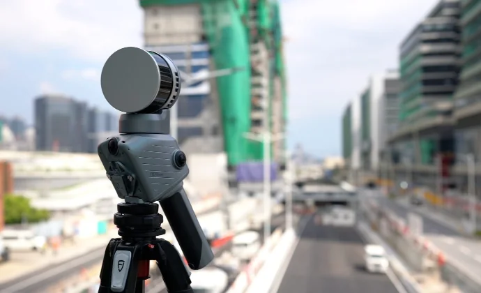
Short answer: A handheld SLAM scanner measures while you walk and is fastest for interiors, tunnels, forests and large areas with many occlusions. A terrestrial laser scanner (TLS) measures from a tripod across several setups and gives higher local accuracy but takes longer in the field. If you need both, hybrid scanners combine the two.
How SLAM works
SLAM stands for Simultaneous Localization and Mapping. The scanner uses LiDAR data – and on some models cameras and an IMU – to continuously work out where it is while it builds the point cloud. That's why it works without GPS, and you watch the point cloud grow in real time on the tablet.
How terrestrial laser scanning works
A terrestrial laser scanner stands still on a tripod and rotates to measure its surroundings. To cover an entire object it is moved between several setups that are then registered together, often using targets or overlap. The method gives very dense, accurate point clouds locally, but every setup takes time.
Comparison
- Field time: SLAM – you walk the area at walking pace. TLS – minutes per setup, plus moving.
- Accuracy: SLAM – FJDynamics specifies about 1–1.2 cm relative accuracy after processing for handheld models. TLS – millimetre level locally.
- Occluded environments: SLAM handles stairwells, shafts and dense vegetation without extra setups.
- Georeferencing: Both can use control points; SLAM scanners with RTK can be georeferenced directly outdoors.
- Post-processing: SLAM data is usually already continuous; TLS needs setup registration.
When to use which
- Handheld SLAM: as-built, indoor scan-to-BIM, plant rooms, tunnels, forest inventory, stockpile volumes. Examples: FJD Trion P2, FJD Trion S2.
- Terrestrial: detailed façade documentation, deformation monitoring and objects that need millimetres.
- Hybrid: projects with both large areas and details that need higher accuracy. The FJD Trion T1 switches between mobile scanning (≤ 1 cm relative accuracy) and tripod mode (4 mm @ 10 m) in one workflow.
Our advice
Start from the deliverable. If the client needs millimetres over a limited area, use a tripod. If large or complex environments must be documented quickly in one pass, SLAM is more efficient. Not sure? Request a quote and describe the job, or read our LiDAR scanner buying guide.
Talk to Norrpoint
Tell us about the job and we will come back with a recommended configuration, availability, and next steps.