Norrpoint

High-precision 3D LiDAR scanners and point cloud software powered by FJDynamics in Sweden.

Norrpoint is operated by Elemtech ABElemtech AB | Org.nr: 559435-4572Glöstorps Röseväg 13, 417 45 Göteborginfo@norrpoint.se

LiDAR Scanners

  • All Scanners
  • FJD Trion P2
  • FJD Trion S2
  • FJD Trion T1

Software

  • FJD Trion Scan Field App
  • FJD Trion Model PC
  • FJD Trion Model Web

Resources

  • Buying guide
  • Industries
  • Case studies
  • Blog

Company

  • Contact Us
  • Support and services
  • Request a quote

© 2026 Norrpoint (Elemtech AB). All rights reserved.

  • Privacy Policy
  • Legal notice
Software
LiDAR Scanners
Knowledge
Contact
  1. Home
  2. /
  3. LiDAR Scanners
  4. /
  5. Handheld LiDAR Scanners
  6. /
  7. X1

FJD

X1

Guided 3D capture with LiDAR, GNSS, and 360° imagery

FJD Trion X1 is a handheld 3D LiDAR reality capture system that connects task planning, guided scanning, GNSS, 360° imaging, issue marking, and reporting in one workflow.

Scanning range
40 m @ 10% reflectivity; 70 m @ 80% reflectivity
Post-processing accuracy
Relative: ±1 cm
Weight (main unit)
900 g
FOV
360° × 62°
Delivery:
5-8 working days

Price depends on configuration, availability, and delivery destination. Send a request and we will prepare a tailored quote.

Not sure which model? Find the right scanner in 4 questions →

About X1

The FJD Trion X1 is a handheld LiDAR scanner for teams that need a guided capture on every site. Plan the task in FJD Trion Model Web, follow the route on the built-in screen, and mark issues in the scan.

X1 outputs 384,000 points per second out to 70 m. Post-processed accuracy is ±1 cm relative and ±3 cm absolute, with up to 5 hours on one battery set.

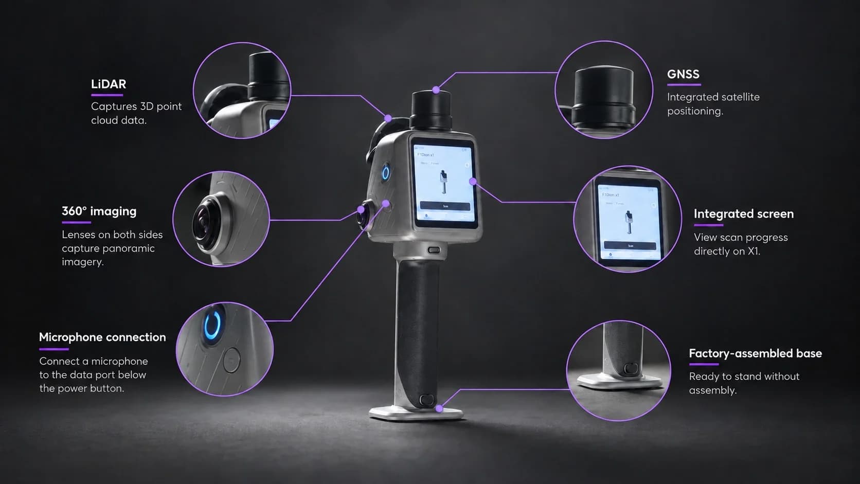
X1 combines GNSS, LiDAR, and 360° imaging. It has a built-in 9.9 cm OLED display and support for an external microphone.

Workflow: plan the capture area, route, and priorities in FJD Trion Model Web, then sync the task directly to X1. Follow onscreen route guidance while capturing. Use the crosshair during scanning to mark an issue and link it to its location in the 3D data. Record field observations by voice. Model Web can transcribe supported languages for review and reporting.

Highlights

  • Guided field workflow from Model Web to X1
  • GNSS, LiDAR, 360° imaging, and a built-in 9.9 cm OLED
  • 384,000 pts/s · 70 m @ 80% reflectivity
  • Post-processing accuracy relative ±1 cm, absolute ±3 cm
  • 2 × 48 MP panoramic cameras · Visual SLAM
  • Up to 5 hours with one set of two batteries · IP54
See all specifications
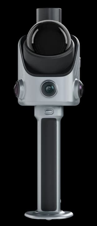
FJD Trion X1 — one device for field-ready reality capture, with LiDAR, 360° imaging, GNSS, integrated screen, microphone connection, and factory-assembled base.

In Action

FJD Trion X1 connects task planning in Model Web with guided handheld LiDAR capture, onsite issue documentation, and cloud-based reporting in one traceable reality capture workflow.

Use FJD Trion Model Web for online project coordination and FJD Trion Model for detailed point cloud editing and analysis on PC or tablet.

Product information
FJD Trion X1 product video

Playing this video loads content from YouTube, which may set third-party cookies.

  • Product brochure (PDF, English) →

Frequently asked questions

FJD Trion X1 is a handheld 3D LiDAR reality capture system designed for teams that need consistent 3D records across multiple sites, operators, and field assignments. It combines LiDAR scanning, 360° imaging, GNSS support, a built-in display, and guided workflows to help teams capture, document, and review real-world conditions more efficiently.

Unlike traditional LiDAR scanners that rely heavily on operator experience, FJD Trion X1 introduces a guided field workflow. Teams can define capture requirements before deployment, guide operators onsite, record observations, and bring all project information together for review.

FJD Trion X1 supports a wide range of reality capture applications, including construction verification, as-built documentation, renovation and MEP records, safety inspections, forensic documentation, urban asset records, and material site documentation.

FJD Trion X1 connects planning, capture, and review into one workflow. Teams can define what needs to be captured before the site visit, guide operators through the task, mark issues during scanning, add voice notes, and review the complete record after capture.

Yes. FJD Trion X1 supports GNSS integration for outdoor workflows that require georeferenced data. It helps connect captured 3D data with real-world coordinates for applications such as site mapping, outdoor asset records, and material yard documentation.

Yes. FJD Trion X1 supports multilingual field collaboration by allowing operators to record voice notes during capture. Model Web helps teams transcribe and review field observations, making it easier to share site information across languages and regions.

This scannerX1
P2 LiDAR Scanner

LiDAR

Range

—

40 m @ 10% reflectivity; 70 m @ 80% reflectivity

Speed

—

200,000 pts/s

Eye safety rating

CLASS 1

Class 1, eye safety

Hyperdense+

—

Yes

Continue scanning

—

Yes

FOV

360° × 62°

360° × 59°

Built-in Cameras

Visual SLAM

Yes

Yes

FOV (side camera)

—

280° × 149°

Resolution (front camera)

—

2 MP

Resolution (side camera)

—

2 × 12 MP

Image export

Yes

Yes

Image format

JPG

.jpg

General Specifications

Weight (main unit)

900 g

700 g (excl. battery, external camera and RTK module); 1200 g (incl. battery and RTK module); 1500 g (incl. battery, external camera and RTK module)

Dimensions

114 × 152 × 329 mm

110 × 106 × 280 mm

Ingress protection

IP54

IP 54

Operating temperature

−20°C to 50°C

−20°C to 50°C

Storage

512 GB, expandable to 1 TB

512G (1TB expandable)

Data export

Wireless network, USB Type-C, USB flash drive

Wireless network, USB Type-C, USB flash disk

Point cloud format

—

.las / .ply / .pts / .e57

Electrical Specifications

Battery life

Up to 5 hours with one set of two batteries

4H (with 1 set of 2 batteries, incl. RTK module, excl. external camera); 3H (with 1 set of 2 batteries, incl. RTK module and external camera)

Power consumption

Approx. 18 W

15 W (excl. external camera); 21 W (incl. external camera)

Power supply

DC handheld battery

DC handheld battery

Charger

67 W fast charging

67W fast charging

Simultaneous dual-battery charging

Yes

Yes

GNSS

RTK accuracy

—

H: 8 mm + 1 ppm RMS; V: 15 mm + 1 ppm RMS

Satellite constellation

—

BDS: B1I / B2I / B3I / B1C / B2a / B2b; GPS: L1 C/A / L1C / L2P (Y) / L2C / L5; GLONASS: G1 / G2 / G3; Galileo: E1 / E5a / E5b / E6; QZSS: L1C/A / L1C / L2C / L5 (IRNSS and SBAS via firmware upgrade)

PPK

—

Yes

Positioning rate

—

10 Hz

This scannerX1
P2 LiDAR Scanner
LiDAR
Range—40 m @ 10% reflectivity; 70 m @ 80% reflectivity
Speed—200,000 pts/s
Eye safety ratingCLASS 1Class 1, eye safety
Hyperdense+—Yes
Continue scanning—Yes
FOV360° × 62°360° × 59°
Built-in Cameras
Visual SLAMYesYes
FOV (side camera)—280° × 149°
Resolution (front camera)—2 MP
Resolution (side camera)—2 × 12 MP
Image exportYesYes
Image formatJPG.jpg
General Specifications
Weight (main unit)900 g700 g (excl. battery, external camera and RTK module); 1200 g (incl. battery and RTK module); 1500 g (incl. battery, external camera and RTK module)
Dimensions114 × 152 × 329 mm110 × 106 × 280 mm
Ingress protectionIP54IP 54
Operating temperature−20°C to 50°C−20°C to 50°C
Storage512 GB, expandable to 1 TB512G (1TB expandable)
Data exportWireless network, USB Type-C, USB flash driveWireless network, USB Type-C, USB flash disk
Point cloud format—.las / .ply / .pts / .e57
Electrical Specifications
Battery lifeUp to 5 hours with one set of two batteries4H (with 1 set of 2 batteries, incl. RTK module, excl. external camera); 3H (with 1 set of 2 batteries, incl. RTK module and external camera)
Power consumptionApprox. 18 W15 W (excl. external camera); 21 W (incl. external camera)
Power supplyDC handheld batteryDC handheld battery
Charger67 W fast charging67W fast charging
Simultaneous dual-battery chargingYesYes
GNSS
RTK accuracy—H: 8 mm + 1 ppm RMS; V: 15 mm + 1 ppm RMS
Satellite constellation—BDS: B1I / B2I / B3I / B1C / B2a / B2b; GPS: L1 C/A / L1C / L2P (Y) / L2C / L5; GLONASS: G1 / G2 / G3; Galileo: E1 / E5a / E5b / E6; QZSS: L1C/A / L1C / L2C / L5 (IRNSS and SBAS via firmware upgrade)
PPK—Yes
Positioning rate—10 Hz
View P2 LiDAR Scanner

Local support

Need help choosing a configuration?

Talk to Norrpoint about X1, your site conditions, and required outputs.

  • Nordic sales coverage
  • Expert configuration support
  • Official quotation available
Contact sales

Explore the range

Related scanners

Compare other FJDynamics LiDAR scanners.

FJD · Handheld LiDAR Scanners

P2 LiDAR Scanner

Compact LiDAR for scan-to-BIM, CAD, and documentation
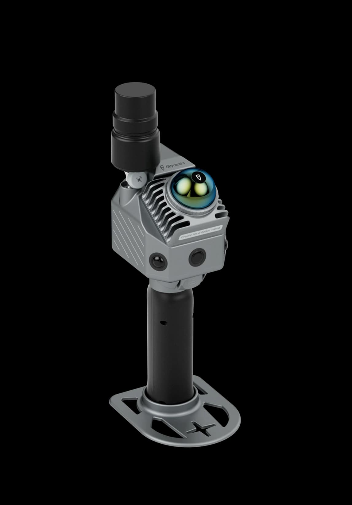
  • Centimeter-level positioning
  • Real-time colorized point clouds
  • Reality capture for BIM and CAD pipelines

A portable LiDAR scanner for reality capture when you need dense point clouds without a tripod-bound scanner.

View details

FJD · Mobile & Terrestrial LiDAR Scanners

T1

Hybrid scanner with 120 m range and 640,000 pts/s
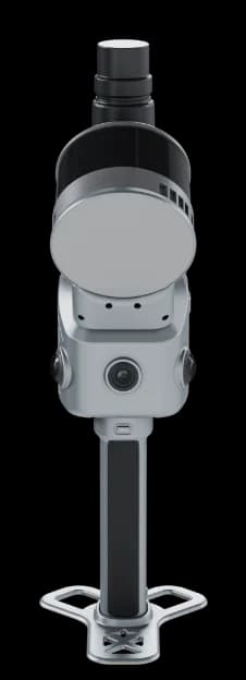
  • Hybrid mobile and terrestrial LiDAR in one scanner
  • 640,000 pts/s · FOV 360° × 270°
  • Mobile: ≤ 1 cm relative accuracy · 0.5 – 120 m

Capture large sites with mobile scanning, switch to tripod mode for higher local accuracy, and combine both in one hybrid LiDAR workflow with FJD Trion T1.

View details

Help choosing

Not sure which scanner you need?

Answer four questions in the buying guide and we'll suggest the scanners that fit your jobs best.

Buying guide →Find your scanner in 4 questions

Ready to specify

Get a setup that fits the job

Tell us where you scan and what you need to deliver. We reply with a recommended configuration, availability, and pricing.

Request a Quote